Introduction: Between one-quarter and one-third
of the Martian atmosphere is cycled through the polar caps,
condensing out in the fall and winter, and sublimating in the spring
and summer. Analysis of Viking Lander pressure curves suggest the
balance between sublimation and condensation rates varies little
from year to year, even for years with global dust storms [1]. This
would suggest that the polar caps recession and growth rates do not
have interannual variations. However, telescopic and spacecraft
observations of the polar caps do show interannual differences, at
least on the local scale.[2, 3]
The Mars Global Surveyor (MGS) monitored the recession
of the south polar in 1997, 1999, and 2001. 1999 was a year free
of global dust storms while 2001 had one of the largest observed
global dust storms in observed Martian history [4]. Mars Optical
Camera (MOC) observations have been used to compare the southern
recession rate in the visual [5]. However, in the visible it is
difficult to distinguish between exposed soil and dark CO2
[6]. We avoid this difficulty by using temperatures derived from
Thermal Emissiion Spectrometer (TES) data to compare recession
rates.
Data Analysis: Kieffer and Titus [6] initially
characterized the south polar recession rate in 1997 by fitting an
arctangent curve to the temperature rise that occurs when soil is
exposed. The inflection point of the arctangent curve was used to
parameterize that season (Ls) when all of the CO2 has disappeared,
referred to as the CROCUS date. The 1997 analysis used a diurnally
corrected 30 µm brightness
temperature. For the 1999 and 2001 analysis, the "2 pm"
30 µm brightness temperatures
were used. Since 1999 and 2001 data sets were analyzed using the
same parameter and the two years represent a clear and a dusty year,
we only compare these two years.
For southern spring, we used data from Ls = 180 to Ls
= 300 (1999) and Ls = 180 to Ls = 285 (2001). The spectral data was
convolved into the T30 synthetic brightness temperature [6, 7].
Observations from each day where rebinned into 60 km x
60 km cells. The arctangent fit was applied to each cell to
determine the crocus date. Poor data fits normally occurred in
regions where there were never any CO2 frost or the CO2
frost was present during the entire season of observation; these
results were excluded.
Results: Figures 1 and 2 show the recession of
the cap edges as a function of season (Ls). Figure 1 is
for 1999, a year free of global dust storms. Figure 2 is 2001 when
a global dust storm occurred early in the spring season. The crocus
map from 2001 is noisier than the 1999 crocus map.
Figure 3 is a difference map between Figures 1 and 2.
A 3x3 box filter was applied to remove high frequency spatial noise.
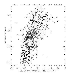
There appears to be a correlation between the changes in the cap
recession rate and the albedo (Figure 4 and 5). Dark areas, such as
the "cryptic" region remain ice covered approximately 4°
to 5° of Ls longer
in 2001 than in 1999. Bright regions, such as the Mountains of
Mitchell, disappear approximately 4°
to 5° of Ls sooner.
A 10 day change in the crocus date is equivalent to having
approximately 12 cm of ice still on the ground.
These observations are consisted with modeling done by
Bonev et al. [8] that shows the sublimation rate of bright regions
is increased by additional downwelling thermal radiation from a hot
dusty atmosphere. The sublimation rate of dark regions is depressed
from a decrease in visible radiation incident on the surface.
References: [1] James, P. B. et al (1992)
In Mars, 934-968. [2] James, P. B. et al. (1979) JGR,
84, 2889-2922. [3]James, P. B. et al. (1987) Icarus, 71,
298-305. [4]Christensen, P. R. (2001) DPS, 33, 42.01.
[5]James, P. B. et al. (2000) Icarus, 144, 410-418.
[6]Kieffer, H. H. et al. (2000) JGR, 105, 9653-9699.
[7]Kieffer, H. H. and Titus, T. N. (2001) Icarus, 105, In Press.
[8] Bonev, B. et al. (2001) DPS, 33, 27.05.